Sand and Gravel aquifers

The sand and gravel reports form part of a series representing the output of a body of work undertaken to re-evaluate previously mapped sand and gravel aquifers and to identify new sand and gravel aquifers. This study resulted in the refinement of existing sand and gravel aquifer mapped extents, the modification of some sand and gravel aquifer categories, and the removal of some previously mapped sand and gravel aquifers, as well as identification of new aquifers. In addition to mapping the extent and depths of the sand and gravel aquifers, the investigations consider the hydraulic properties.
The efforts of all those who worked on updating our knowledge of Sand and Gravel aquifers in Ireland has culminated in a series of detailed reports, available to the public for viewing access.
Sand and Gravel aquifer maps
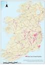
Mapped Sand and Gravel aquifers are readily available on the Geological Survey Ireland website. Please click the link below for more information.
Sand and Gravel aquifer reports
The Sand and Gravel reports have been finalised and uploaded to the Geological Survey Ireland website, they are freely available to view by clicking the link below.