Karst groundwater
The two principle karst regions that have been examined in the GW3D project are North Cork and the Rathcroghan Uplands of Roscommon. The rationale for choosing these areas was based on the reliance on groundwater for public drinking water in each area, and previous and current scientific investigations.
What is karst groundwater?
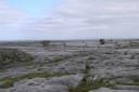
An area of limestone in which the landforms are solutional in origin, and in which the drainage is underground in solutionally-enlarged fissures and conduits. Limestone is the dominant rock type in Ireland and is an important groundwater resource.
Rathcroghan Uplands

Dye tracing was conducted during 2015 and 2016 in the Rathcroghan Uplands to assist protection of groundwater supplies.
North Cork
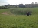
In North Cork, groundwater provides over 30,000 m3/d of drinking water via public water supplies, the majority of which are karst springs. Previous hydrogeological investigations have been conducted by Geological Survey Ireland and EPA in relation to these springs. The Groundwater 3D work represents a continuation of work in these areas.