Geological Mapping – Activities
1:50k Mapping – Quaternary Field Programme
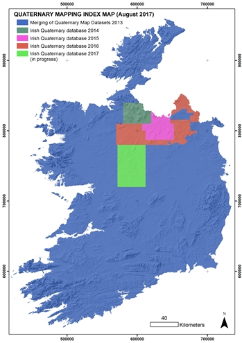
Our Quaternary geology field programme is gathering outcrop, borehole and shallow geophysical data in areas where existing data coverage is low, to improve the National Quaternary map. A new digital field data collection system has been developed in-house. The map is updated annually after the results of each summer field season have been compiled.
1:50k Mapping – Bedrock Data Compilation
We are compiling bedrock point data, such as outcrop descriptions, borehole locations and logs, and structural measurements, with the existing rock unit mapping. Tellus geophysics and geochemistry are used to guide re-interpretation, supported by field visits and borehole drilling as required. Unpublished data compilations for the ‘geourban’ areas around major cities are available on request. Compilations published to date include a Northeastern block and a North Midlands block.
Bedrock 100k live
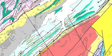
We have revised the national 100k bedrock geology map, to remove the numerous geological and digital errors that existed in the previous version. In addition, the data have been fitted to the new OSI detailed coastline and transformed to the ITM projection. The map is linked to a Lexicon table that provides a definition and description for every rock unit on the map. A rock aquifer category classification has been included so that a single map serves for bedrock and groundwater applications. The map was published online as a free download in October 2016 and will be integrated into our online map viewers. We will maintain the map as a ‘live’ dataset, updating it as new 50k mapping progresses.
Geotechnical Database
We continue to populate and develop the geotechnical database and viewer with site investigation data submitted by industry. The current database holding is over 7500 reports with 134,000 boreholes; 31,000 of which are digitised.
Drilling
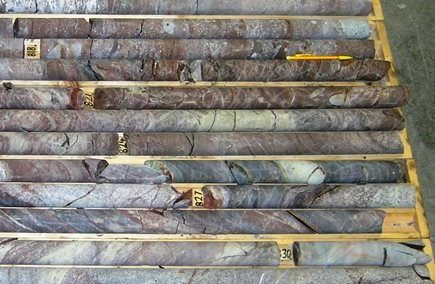
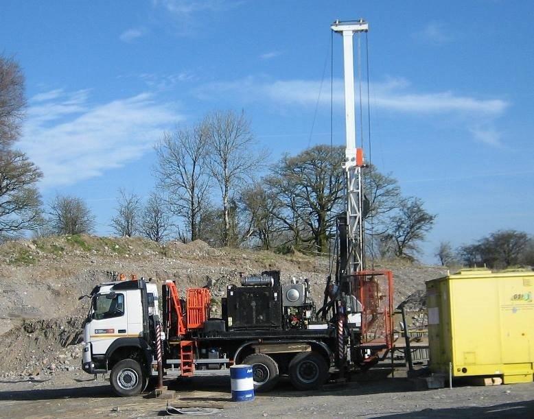
In many areas of Ireland, exposures of bedrock or Quaternary subsoils at the land surface are not sufficiently common to provide enough information to construct a geological map or interpret the geology. In such cases, we can drill boreholes – with the landowners permission – to obtain samples of the sub-surface. In bedrock, we use diamond drilling to extract a cylinder of rock, 47mm diameter and often several hundred metres long depending on the target depth. These cores are stored in our core store for long-term reference. For subsoils, we use a rotary auger to extract samples of the unconsolidated deposits over the first few metres below the land surface.
Public Enquiries
We welcome enquiries from students, consulting engineers and others about the Quaternary, geotechnical or bedrock geology of Ireland. General enquiries should be directed to our dedicated duty geologist who will relay it accordingly.
Enquiries are initially responded to within 3 working days. Specific questions about the Geological Mapping programme products or activities can be addressed directly to the programme.
Hyperspectral Image Analysis
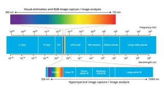
The Geological Mapping Programme is working with the hyperspectral data to demonstrate the potential of hyperspectral core scanning to improve stratigraphy, mineral exploration, geothermal exploration and potentially improve our geological map products.