Enclosed depressions are regarded as the most common landforms of karst. They function to funnel rainfall and runoff vertically down to become recharge. They range in diameter from a few metres to tens of kilometres and in depth from a few centimetres to hundreds of metres. The smallest of these features are termed dolines.

What is a doline or sinkhole?
A doline (or sinkhole as it is more commonly called in North America) is a natural enclosed depression found in karst landscapes. Dolines are the most common landform in karst areas. They are described as small to medium sized closed depressions, ranging from metres to tens of metres in both diameter and depth. Once created dolines function as funnels, allowing the direct transmission of surface water into the underlying karstic bedrock aquifer. They may occur as isolated features or in clusters causing a pock-marked land surface (Ford and Williams, 2007).
How do dolines form?
Dolines are formed by two main methods: the slow solutional removal of rock from the surface downward (solution doline), or by the collapse of overlying rock or overlying material into an underground cave or chamber (collapse doline). Most dolines are considered polygenetic in origin and are usually formed from a combination of solution and collapse; however one of these processes usually dominates their appearance, whether it is catastrophic or gradual.
 Source Waltham, A., Fell F. and Culshaw M. 2005. Sinkholes (or dolines) and subsidence: karst and cavernous rocks in engineering and construction. Springer. Berlin.
Solution dolines form in such places such as joint intersections. Surface runoff will focus at these areas of weakness, leading to the solution of the bedrock. Water and solutes will then move downwards through the bedrock openings (such as at joints and bedding planes). The result is a funnel-shaped depression on the surface. Solution dolines are considered to be formed by a gradual process of sagging or settling of the overlying deposits into the hollow left by an area of dissolving rock. Solution dolines are usually characterised by gentle slopes with no obvious rupturing of the soil or surface.
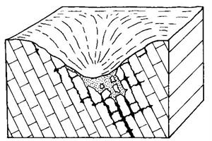 |  |
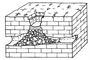
| Solution doline formation (Jennings 1985) | Solution dolines in County Roscommon |
Collapse dolines usually occur very suddenly where the bedrock or subsoil material collapse into and underlying void. Cover collapse dolines, sometimes known as dropout dolines are very common in Ireland. They occur in karst areas covered by unconsolidated material, such as glacial till. They form by the sudden downward movement of the overburden and usually form in areas where the overburden is somewhat cohesive. They occur in a process called 'piping', where a soil or subsoil arch, which has formed due to removal of material at the bottom of a layer of overburden, suddenly gives way (White, 1988). Although there must be a highly efficient pathway established for sediment transportation in order for the soil arch to form and grow, a large bedrock hollow is not necessary for their development. Cover collapse dolines are characterised by vertical or steep-sided collapses, with a very sharp break in slope and often have stepped sides, where soil is exposed. Over time, however, their slopes may degrade and infilling sediment may build up giving these dolines the morphology of solution dolines (Ford and Williams, 2007).
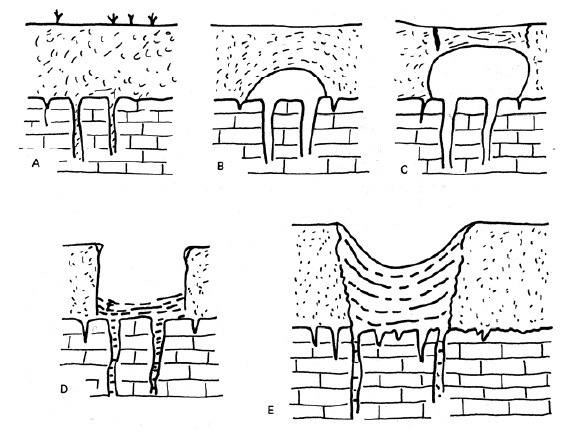 The formation of a cover collapse doline:
A) Solutional openings in the bedrock wash material downward,
B) An small arch forms in the subsoil where the material is being washed away from,
C) The void grows in size as more material is being down-washed until it reaches a critical point and starts to rupture,
D) The arch suddenly collapses as it can no longer support its own weight,
E) Overtime the vertical sides will degrade and the hole will become less deep.
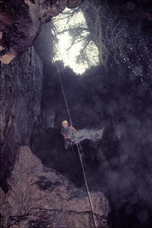
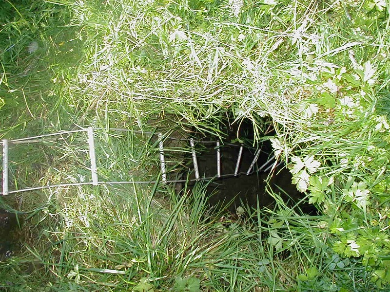 A) A small recently collapsed pipe failure. Photograph shows caver's ladder going down into opening.
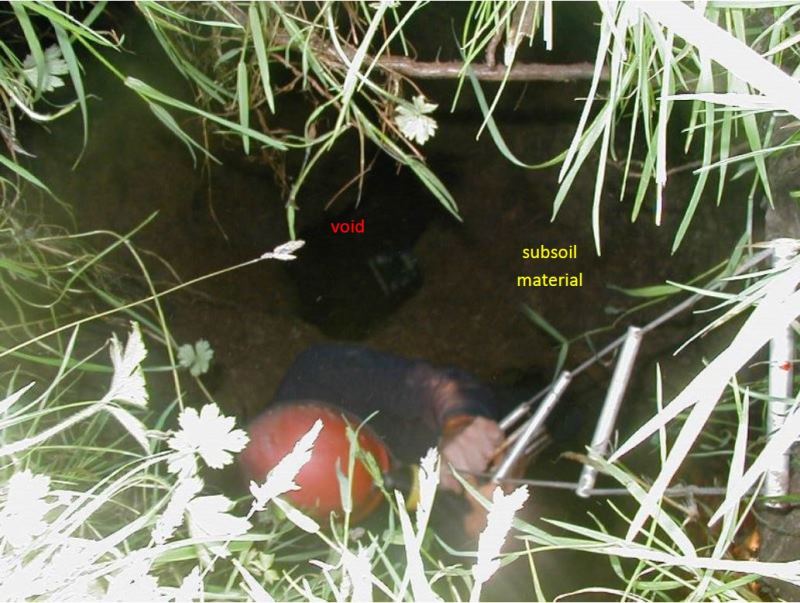 B) This shows the same collapse feature with a caver going down the ladder inside. Note the void and the neck of subsoil material about half way down.
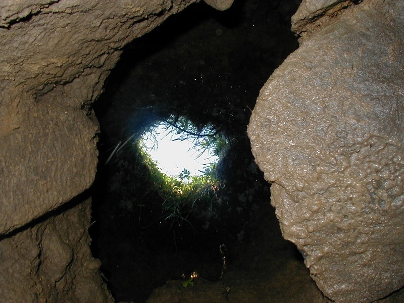 C) This is the same collapse feature from the base of the void in the bedrock. Again, note the subsoil neck about half way up, the void and the small grass opening as seen in Photo A.
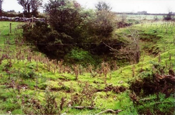 A cover collapse doline in Roscommon.
Bedrock collapse dolines are caused by collapse of bedrock into an underlying void. They are commonly due to the collapse of the roof of a cave and can be catastrophic. Although solution is a significant process driving the creation of these dolines, they are principally due to mechanical processes, although the collapse must be preceded by sufficient solution of the bedrock to form a void into which the material can fall (Williams, 2004a). They can also be caused by lowering of the water table removing buoyant support. They are usually characterised by a high depth to width ratio and vertical bedrock sides, although in time they may degrade and infill. These are less common in Ireland.
 |  |
| Bedrock collapse Doline Formation (Jennings 1985) | Pollelva doline in Co. Clare. Photo: Colin Bunce, Clare Caving Club |
What is the likelihood of the ground opening up underneath me?
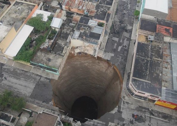 Sinkhole in Guatemala City, May 29th 2010. Photo source: Luis Echeverria, US EPA.
Catastrophic events of buildings falling down into large collapse features, such as the recent sinkhole in Florida, are extremely rare. However, there have been reports of minor collapses of roads and fields in Ireland. These are found in karst areas prone to solution and many landowners fill these in on a regular basis. The photograph below is taken from field in North Cork. The photograph shows a rescue of a cow that was trapped at the bottom of a cover collapse doline as it suddenly opened up from under her.
 A rescue operation of a cow that ended up at the bottom of sinkhole that opened up suddenly underneath her, North Cork. Photo source: O'Brien.
There are estimated to be over 6,000 dolines in Ireland. Geological Survey Ireland host maps that can help you to determine if karst development in likely in your area. Firstly, the Bedrock Geology Map of Ireland (available in 1:100,000 scale) will show you if you live in a limestone area. There is also a karst landform database, which will show you some of the recorded landforms in your area including dolines. These datasets are available for viewing on our interactive public viewer site or for downloading. Please visit our Karst databases page for further information.
Have you found one of these features?
If you are worried about sinkholes in Ireland, or have additional information about sinkholes or collapse features please contact the Groundwater Section at groundwaterinfo@gsi.ie
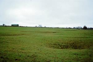
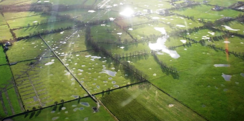 Sinkholes or dolines, after heavy rain, near Athenry Co. Galway, Photo source, Tobin Consulting Engineers.
Other types of enclosed depressions
Compound enclosed depressions, with hollows within hollows, may develop by the amalgamation of dolines or by the development of sub-basins within a larger feature. These are termed uvalas or compound enclosed depressions. Larger enclosed depressions, with floor areas of hundreds of square kilometres in some cases, are found in some karst areas, particularly those of the Mediterranean and tropical areas where karstification is advanced. These landforms are termed poljes, the Serbo-Croat word for a field, emphasising the relatively flat-floored, sedimented base of the feature. They often have complex internal drainage systems.
Some large enclosed depressions on the Burren:
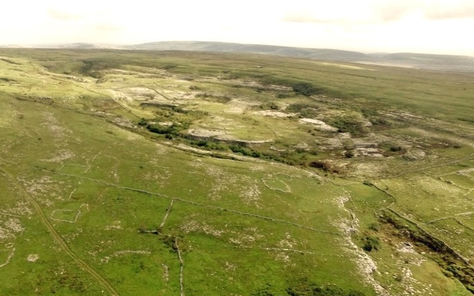 A) Aillwee Hill uvala. Photo source: Aerpas.
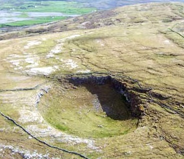 B) Slieve Carran doline. Photo source: David Drew.
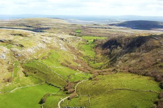
C) The Glen of Clab dry valley-linear doline. Photo source: David Drew.
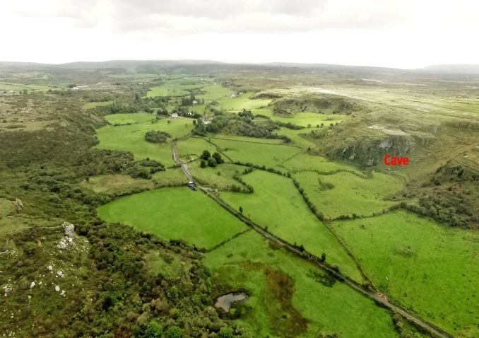 D) Kilcorney depression showing the channel leading to the Cave of the Wild Horses which can function as an estavelle. Photo source: Aerpas.
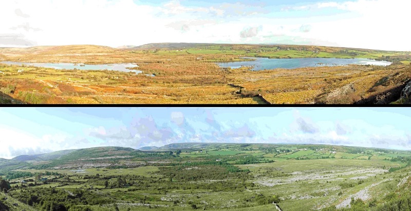 A part of the polje, 9 km2 in area, centred on Carron, in the central Burren, which contains several seasonal turloughs, shown under high (top) and low (below) water conditions. Photos source: Colin Bunce.