Climate Research at Geological Survey Ireland
Geological Survey Ireland teams are involved in climate research in a number of key areas. We collaborate with partners in Ireland and internationally to better understand the interaction of the solid Earth with our atmosphere, biosphere, and hydrosphere. We also provide data on past climates, the ongoing impact of climate change on our natural world, and we look at how these impacts will affect us into the future.
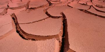
Groundwater research – droughts
The Groundwater team in GSI have a number of projects investigating the impact of climate change on our groundwater aquifers. These impacts were highlighted in 2018 with significant droughts affecting much of the country. We are using conceptual models and water balances to understand current and future groundwater resources, see GW3D project. In addition, the GWClimate project is assessing the impacts of climate change to groundwater resources by monitoring groundwater data. INTERREG-funded CatchmentCARE project is installing groundwater monitoring stations in the Border counties. The EU-funded GeoERA project, TACTIC, is investigating tools for assessing climate change impacts on groundwater and is producing current and future groundwater recharge estimates (for further details about research activities, please see the Groundwater programme).
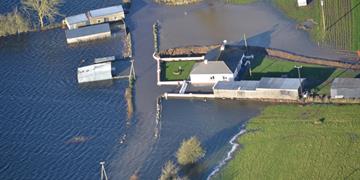
Groundwater research – flooding
Since 2016 GSI, in collaboration with research partners, has monitored and investigated groundwater flooding in the karst areas, in particular in Roscommon, Clare, Galway and Mayo. This work is using ground based measurements and satellite data to assess the impact of turlough flooding in local communities – see GWFlood project – and the longer terms trends to examine whether these flood events are increasing in scale and frequency.
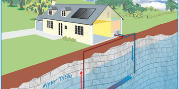
Geothermal research
GSI has recently been expanding the geothermal research team with particular interest in investigating the potential for geothermal energy for district heating and highlighting the use of shallow geothermal for residential heating, see geothermal projects. As part of this programme of work, and in the context of the Climate Action Plan 2019, in 2020 GSI will publish a Roadmap for the Development of Geothermal Energy for District Heating. We are also funding and collaborating with national and international partners to support research policy and technological and scientific development in this area for the Irish market.
Coastal change research – earth observation
We are partners on the international Coastal Erosion from Space project funded by the European Space Agency. The project is developing & demonstrating innovative Earth Observation (EO) products, including satellite data, to monitor and measure volumetric changes in sediments in coastal areas. Link to ESA project
Coastal change research – heritage and coastal erosion
In collaboration with the Discovery Programme and partners in Wales, we have been funded through the Ireland Wales European Territorial Co-operation programme to run the CHERISH (Climate, Heritage and Environments of Reefs, Islands and Headlands) project using state of the art technologies to investigate and quantify coastal change and its effect on maritime cultural heritage. The Marine and Coastal Unit in GSI have been mapping coastal cliffs, islands and headlands to establish baseline data and estimate the rate of erosion / deposition and the impact of climate change in these areas over time. Link to CHERISH project
Coastal change research – sea-level change
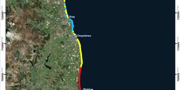
Our Marine and Coastal Unit and Geological Mapping Programme have developed a Coastal Vulnerability Index (CVI) to evaluate the impact of sea-level rise on the coast of Ireland. This project is developing maps and visual tools to identify coastal areas that are prone to coastal flooding. The project is also modelling potential future inundation resulting from sea-level rise. The products from this project will help planners and climate mitigation groups to prepare appropriately to future threats. Link to CVI project
Landslides research
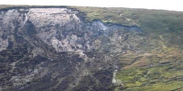
As a result of climate change, we are experiencing an increase in the number and frequency of landslide events, primarily due increased rainfall. Since 2003 we have been developing our landslide project with the establishment of the Irish Landslides Working Group and their subsequent report on Landslides in Ireland and a landslide susceptibility map. Following this have also developed a database which now hosts several thousand individual events in Ireland. We are currently working with key stakeholders and research groups to further develop this database and a landslide hazard map.
Terrain motion research
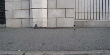
Ground motion, both subsidence and heave, can be caused by underlying geological conditions, which may be exacerbated by extreme climate conditions. GSI are working with ESA and researchers to monitor ground motion by earth observation and investigate these incidents on the ground. This work will ultimately lead to the development of a national ground motion monitoring service. Two project completed to date compared recorded ground motion with known differences in the geological make-up of the ground, particularly the GSI geotechnical database and the GSI National Quaternary map (spatial changes). Link to PanGEO Terrain Motion project.
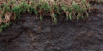
Carbon sequestration in soil
Soil and peat are important sources of carbon on Earth, acting as natural reservoirs that absorb more carbon than they release. Ireland’s soil and peat are a potentially significant source of carbon sequestration. GSI’s Tellus programme acquires data relevant to understanding soil carbon and peat thickness as part of its geochemistry and geophysics programmes. Link to Soil Carbon and Peat Depth Assessment research project.