Which Geological Survey Ireland programme do you work in?
Marine and Coastal Unit
What do you do?
I work both offshore and onshore conducting research to further develop and enhance knowledge in marine and costal environments around the Irish Coast.
Why does your programme do the work it does?
Our aim is to further the knowledge and understanding of our underwater landscapes to provide key baseline data for Ireland's marine sector. Furthermore, to record climate change impacts on cultural heritage sites around Ireland's coastline and to further our understanding of coastal erosion processes
When do you do fieldwork and what does it involve?
My fieldwork involves seabed surveying with INFOMAR, acquisition of GPS transects for ESA (European Space Agency) project, and conducting drone and laser scanning with CHERISH!
Where does your work take you?
All around the Irish coast! We also have marine related projects within several EU countries, providing opportunities to travel.
Which Sustainable Development Goals (SDGs) can be met by the work your programme does?
- SDG 4: Quality Education
- SDG 6: Clean Water and Sanitation
- SDG 7: Affordable and Clean energy
- SDG9: Industry Innovation and Infrastructure
- SDG 13: Climate Action
- SDG14: Life Below Water
- SDG 15: Life on Land
- SDG 17: Partnerships for the Goals
Skills involved:
- Teamwork
- Operating fieldwork equipment
- Data acquisition
- Data processing and management
Below are images of some of the things you can see and do whilst working in the Marine and Coastal Unit section.
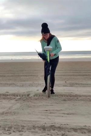 | < conducting GPS transect work for the ESA project. |
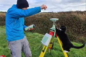 | < the CHERISH survey cat helping out the team! |
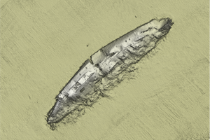 | < RMS Lusitania. To date, INFOMAR has surveyed over 400 shipwrecks . RMS Lusitania is orientated in a northeast–southwest direction and measures approximately 241m on the seafloor standing over 14m high above the seabed. |
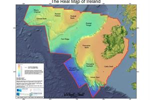 | < The Real Map of Ireland. Ireland's marine territory is 10 times greater than the land area. Ireland is posed to be the first in the world to map its entire seabed. |
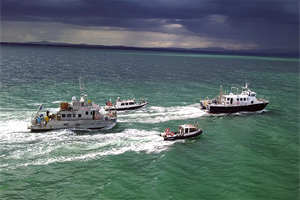 | < the INFOMAR inshore survey fleet. |