This activity focusses on the Tellus programme. By using the following pages, Airborne Survey FAQs and Ground Survey FAQs, find the answers to these questions:
- Where does the name "Tellus" come from?
- What data does the Tellus survey collect?
- What are the two types of Tellus surveys?
- At what survey altitude does the Tellus plane fly?
- What is the average speed of the Tellus plane?
- What is the registration number of the Tellus plane?
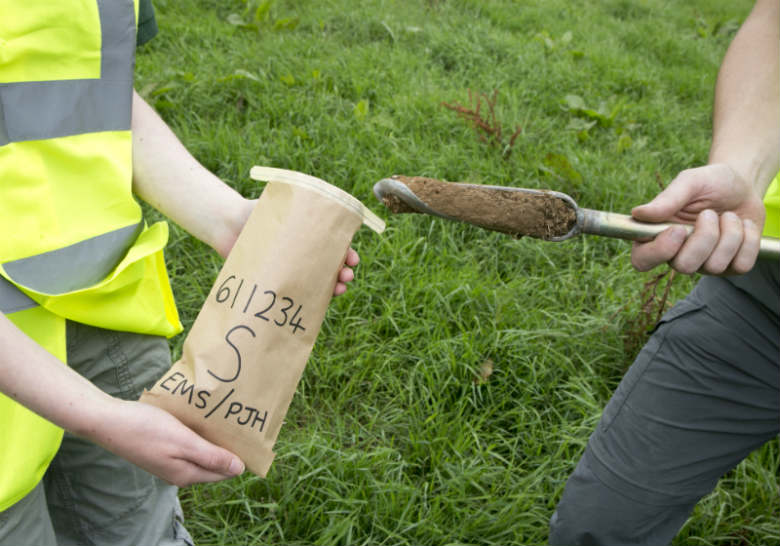
- What is the name of the hand tool used to collect a soil sample? Watching this video may also help.
- At what depth are the two soil samples collected?
- True or false: All of the data collected by the Tellus survey is freely and publicly available.
- Using the 'Tales from Tellus' story map, where was the most westerly image taken?
We'd love to see all of your answers combined and drawn as a diagram – the more imaginative, the better! Maybe this could be drawing the Tellus plane in the sky and a ground survey sample being taken with labels such as the height of the plane and the depth of the soil samples.
When you have completed the activity, please upload your creations to twitter (@GeolSurvIE and @TellusGSI) or facebook (Geological Survey Ireland) with the hashtags #HomeSchoolGeologists and #TellusSurvey. We look forward to seeing what you've made!

Plane used for the airborne survey
Soil sampling