Geochemical surveying characterises the baseline chemistry of soil, stream water and stream sediment by taking samples of these materials by hand at a density of approximately one sample every 4 km². Multi-element laboratory analyses of these samples to trace level allows a suite of some 55 maps to be produced, useful for mineral exploration, agricultural productivity and environmental management.
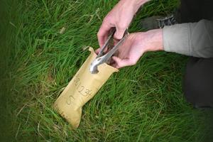
Soil samples are collected by teams of trained samplers, normally working in teams of two. Samples are collected using a hand tool called an auger. Two samples are collected; one at 20 cm deep and one at 50 cm deep, with approximately 1 kg of soil taken from the upper and the deeper layers — a similar weight and volume to that of a bag of sugar.
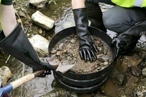
.jpg?RenditionID=15) Stream sediment samples are collected from the stream bed, using a hand shovel, and a wet-sieving method removes the finest particles for analysis at a laboratory.
Stream sediment samples are collected from the stream bed, using a hand shovel, and a wet-sieving method removes the finest particles for analysis at a laboratory.
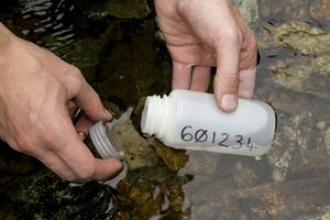
Stream water samples are collected in bottles. Some of these bottles of stream water are tested in the field base for alkalinity and conductivity, while other samples are carefully filtered at site to remove particles before analysis at a laboratory.
Data from sample sites are mapped to reveal the regional trends in the changing chemistry of the earth’s surface.
The results aren’t intended to provide information on individual landholdings however we are happy to provide results that have been requested on the day of sampling.
Click below to view an infographic with more facts and information on our ground survey

What samples are collected?
Our geochemical ground survey involves the collection of two types of sample: soil and stream samples
Soil samples
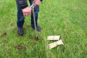 Soil samples are taken at each site with an hand tool called an auger, at 20 cm and at 50 cm depths. Samples are collected into paper bags and a detailed site description is taken to accompany the samples.
Stream samples
Drainage sampling involves sieving stream sediment, collecting stream water and vegetation samples that give us an indication of trace elements present in the stream catchment. At each site, sediment is wet-sieved. After sieving the fine sediment (<150microns fraction) is allowed to settle in a collection dish before being decanted into paper bags for drying and laboratory analysis. The material that is >150microns and <2mm is then panned, any heavy minerals are observed at site using a hand lens before being collected in a paper bag for future reference. Water samples are filtered on-site, collected into plastic containers, acidified at the field base and sent for laboratory analysis. Other water samples are collected and measured for the pH, conductivity and alkalinity of the stream water.