Geochemical surveying characterises the baseline chemistry of soil, stream water and stream sediment by taking samples of these materials by hand at a density of approximately one every 4 km². Multi-element laboratory analyses of these samples to trace level allows a suite of some 55 maps to be produced, useful for mineral exploration, agricultural productivity and environmental management.
Surveying has already been completed across the border region. Results from the border region survey are available to view and download free of charge.
View the current field survey sample areas**
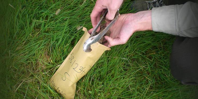
Soil samples are collected by teams of trained samplers, normally working in teams of two. Samples are collected using a hand tool called an auger. Two samples are collected; one at 20 cm deep and one at 50 cm deep, with approximately 1 kg of soil taken from the upper and the deeper layers — a similar weight and volume to that of a bag of sugar.
.jpg?RenditionID=17)
Stream sediment samples are collected from the stream bed, using a hand shovel, and a wet-sieving method removes the finest particles for analysis at a laboratory.
Stream water samples are collected in bottles. Some of these bottles of stream water are tested in the field base for alkalinity and conductivity, while other samples are carefully filtered at site to remove particles before analysis at a laboratory.
Data from sample sites are mapped to reveal the regional trends in the changing chemistry of the earth’s surface.
The results aren’t intended to provide information on individual landholdings however we are happy to provide results that have been requested on the day of sampling.