Landslide Susceptibility
A landslide susceptibility map identifies areas which are subject to landslides and is measured from low to high. The landslide susceptibility map takes into account where the landslides occur and what causes them (slope, soil type and the impact of the flow of water in an area).
Access to the National Landslide Susceptibility Map
The national landslide susceptibility map is available in digital format for download and can be viewed online at the GSI's dedicated Landslide Viewer along with GSI's National Landslide Database and a summary report here.
Susceptibility Mapping for Ireland
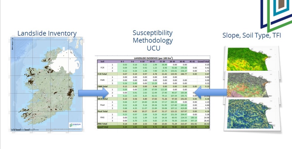
The aim of this mapping is to identify areas predisposed to landslides. To produce the map the following factors were considered:
- Where do landslides occur in Ireland - Recognise the extent of problem
- What triggers landslides in Ireland - elevations, slope, soil type
- When did they occur – document archived data sources and recent events
The landslide susceptibility mapping methodology developed for Ireland needed to be:
- Repeatable – applied to areas other than chosen pilot study areas (National scale)
- Robust – (e.g. National Quaternary mapping) The Irish context i.e. “Peat stability” also had to be considered
The methodology Applied - The Unique Condition Unit (UCU). The concept is that if a landslide has occurred in a particular set of conditions, then if those conditions occur elsewhere those locations would also be susceptible to landslides.
The term 'susceptibility' should not be confused with 'hazard' and 'risk'. Landslide hazard is the potential for a landslide to cause damage and landslide risk shows how vulnerable or the potential for loss an area has due to a landslide.