Publications

The Geological Heritage of County Cork
Published 9 May 2024
The audit of County Geological Sites in County Cork was completed in 2023. The audit was carried out by Ronan Hennessy, Robert Meehan, Vincent Gallagher and Clare Glanville. The Cork Geological Heritage Project was supported by Geological Survey Ireland, Cork County Council and The Heritage Council.
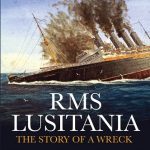
RMS Lusitania: The Story of a Wreck
Published 17 November 2019
This book provides a fresh approach to the RMS Lusitania story by drawing on new research, a multitude of available sources and state-of-the-art 3D multibeam imagery of the wreck and it documents the 2015 commemorative events marking the centenary of the loss of this once great liner.
‘Karst of Ireland: Landscape, Hydrogeology, Methods’ David Drew
Published 4 December 2018
David Drew has succinctly pulled together his 45 years of experience in applied research and practical investigative work to provide this revealing guide into Irish Karst and how to further our understanding of karst.
Geology of the Dingle Peninsula-A field guide
Published 22 May 2018
This geological field guide to the Dingle Peninsula includes detailed and richly illustrated descriptions and interpretations of localities where key elements of Dingle geology can be examined. A new 1:50,000 bedrock geological map of the peninsula is also included.
Dissenting Spirit: Thomas Weaver, Geologist and Mining Engineer
Published 8 December 2017
This book will appeal to anyone interested in the science and industry of the early nineteenth century, as well as for students of the philosophy and history of science.
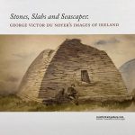
Stones, Slabs and Seascapes: George Victor du Noyer’s Images of Ireland
Published 22 November 2017
The beautifully illustrated hardback book accompanying the exhibition currently at the Crawford Art Gallery in Cork.
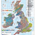
Bedrock Geology of the UK and Ireland Map 1:1.25M scale
Published 10 August 2017
We collaborated with our colleagues in the British Geological Survey and the Geological Survey of Northern Ireland to publish a summary map for Britain and Ireland, derived from our respective national maps. The map is intended primarily as a teaching resource and geological summary for international projects.
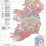
Quaternary Geological Map of Ireland 1:500,000
Published 10 August 2017
This All-Ireland Quaternary geology map at 1:500,000 scale is an amalgamation of Quaternary maps from Ireland and Northern Ireland, a joint project between GSI and GSNI.
Quarry Directory 2014
Published 4 November 2014
The Directory of Active Quarries and Pits in Ireland includes information for each site on: •The location of active sand and gravel pits, crushed rock quarries and dimension stone quarries. •Contact details for quarry operators. •Details on the activities and processing carried out on-site. •A list of products available from each quarry or pit.

Warships, U-Boats & Liners – A guide to shipwrecks mapped in Irish waters
Published 1 October 2012
It is estimated that up to 15,000 shipwrecks may lie in Ireland's designated waters, shipwrecks that tell of cruel wars, thwarted ambitions, political machinations and sunken treasures. This beautifully illustrated volume presents sixty of those shipwrecks and tells a colourful tale of Ireland's maritime heritage.
An A to Z of Geology
Published 7 December 2009
A Sherkin Island Marine Station in association with Geological Survey Ireland publication for all ages.
A Report by the Irish Landslides Working Group
Published 1 October 2006
This publication has been written by members of the ILWG and produced by the GSI. The main objectives are to inform the wider public in Ireland about landslides in general, and also to provide technical data and discussion on some core issues for those who have a professional or academic interest, or indeed responsibility with regard to landslides.
Understanding Earth Processes Rocks and the Geology of Ireland
Published 1 September 2004
The book is written primarily as a resource for teachers, but will also be of interest to members of the general public who would like to know more about rocks and the origins of the landscapes of Ireland.