Geological Survey Ireland carries out geological drilling as part of several programmes. Our
Geological Mapping
team use the data to improve our subsurface understanding and enhance
our maps and 3D models of the Irish crust. The data is also used to
support geotechnical and geological engineering studies.
Our Groundwater and Geothermal teams also use the data to assess our groundwater resources and to estimate geothermal heat below the surface.
Geological Survey Ireland operates two drilling rigs; one rig is used for rotary coring and the other is used for auguring Quaternary samples. For more information about how we use these, please see our Frequently Asked Questions
GSI Drill Rigs
The rotary coring rig is a Boart-Longyear LF90D
mounted on a 6x6 Volvo FMX truck (pictured below). This rig has a depth
capacity of 1,193m and can use BQ to PQ rods.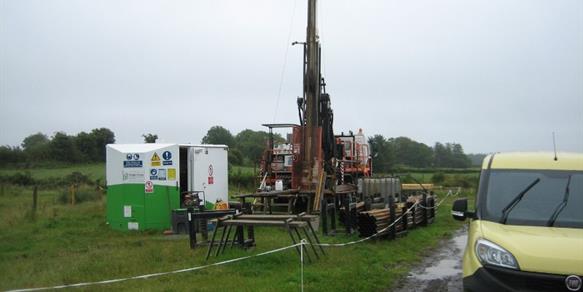
The Boart-Longyear
is used for bedrock investigations. The operations of this rig are
crucial to the Land Mapping programme's 1:50k work, and is used by the
Groundwater programme on several different projects.
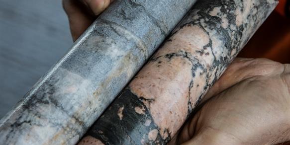
This rig can collect core which is stores in the GSI corestore and can be accessed e.g. for research projects or by companies for site surveys.
Our second rig is a Dando Geotech 7.5 mounted on a 6x6
Iveco truck. This rig is used for continuous flight augering as part of
the Land Mapping programme's Quaternary mapping projects, although other
programmes also use it to support ongoing projects. 