Please note the following bathymetric data is at a preliminary stage and has not undergone processing. It is not to be used for navigation (8 June 2023).
The 2023 INFOMAR inshore survey season has started along the Burren & Cliffs of Moher UNESCO Global Geopark coast in exceptional weather conditions. This allowed for Geological Survey Ireland survey vessels R.V. Lir and R.V. Galtee to survey over a stretch of notorious coast from Liscannor Bay to Black Head, on the Burren coast in north County Clare (Image 1).
One highlight included data acquired over the infamous Kilstiffin Reef which is shrouded in fascinating local mythology and rumoured to be the resting place of the sunken city of Kilstiffin. North of this site, 3D seabed data has revealed the brilliant marine geology hiding at the foot of the Cliffs of Moher. Huge slabs of rock and undulating reefs can be seen on the data rising sharply from deep water, shedding light on why the reef below the lookout point of Aill na Searrach (the Leap of the Foals) is world famous in the big wave surfing scene (Image 2). This wave is known as Aileens.
Heading further north from Ireland's number one tourist attraction, our seabed data reveals the transition from Namurian (326 to 313 million years old) shale and sandstone cliffs to the older (346 - 330 million years old) limestone of the Burren. Fisherstreet Bay at Doolin is host to a gently sloping limestone reef (Image 3), and near Fanore the stepped glacial features of the Burren geology can be seen extending out in to Galway Bay (Image 4). At the time these rocks were formed, Ireland was in the Tropics. The limestone was formed in shallow, warm seas and are rich in marine fosils. The trasition to shale signifies a change in environment to a deltaic conditions.
INFOMAR (Integrated Mapping for the Sustainable Development of Ireland's Marine Resource) is funded by the Department of the Environment, Climate and Communications (DECC), and delivered by joint management partners Geological Survey Ireland and the Marine Institute.
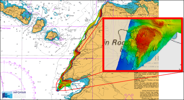 Image 1. Mapping area for the start of the 2023 INFOMAR inshore survey season.
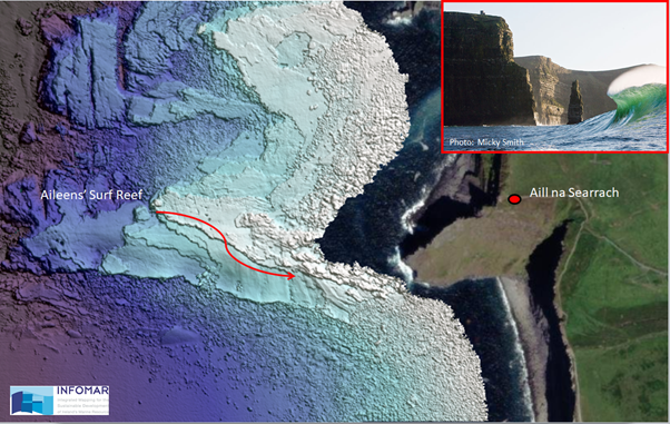 Image 2. Reef below Aill na Searrach.
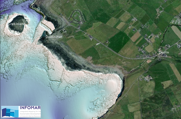 Image 3. Doolin and Fisherstreet Bay.
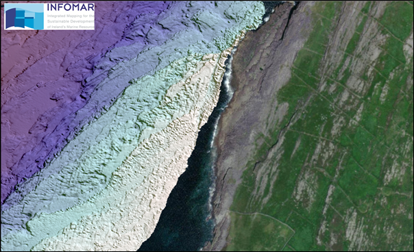 Image 4. Fanore and the Burren.