Title
| Cover
| Abstract | Price | IBSN
|
A Guide to Ireland's Mountain Summits (Walking Guide)
| 
| In Ireland there are 269 mountain summits that are 600 metres or higher, and with a prominence of 15 metres or more. These are The Vandeleur-Lynams. And there are 404 summits with an elevation of at least 500 metres, with a prominence of 30 metres or more. We call these The Arderins. For the first time both these lists are published together, along with lists of Ireland’s 27 County Highpoints and the island’s Hundred Highest mountains, using updated data and information as contributed by the MountainViews.ie community. This book will undoubtedly prove to be an invaluable resource for the peak-bagger, summiteer and hillwalker alike.
| €12
| 9781848891647
|
Northern Ireland A Walking Guide (Walking Guide)
| 
| This revised guide presents top-class walking routes in Northern Ireland. From rugged mountain peaks to spectacular coastal scenery, from challenging hill walks to shorter woodland and waterside excursions, there is something for everyone. Every part of the region is covered, from the mountains of Mourne to the Giant’s Causeway, from Fermanagh’s ‘lake district’ to the rolling Sperrins. Routes vary from two-hour strolls to eight-hour upland challenges. Much thought has gone into making this guide easy to use: each route, prefaced with a quick-reference summary, is illustrated with a clear sketch map; descriptions include detailed access information while points of interest are highlighted – flora and fauna, history, archaeology and folklore. A compact region with huge scenic variety, Northern Ireland is ideal for walking yet is often overlooked. This authoritative guide is changing that, using the author’s enthusiasm and knowledge.
| €15
| 9781848891500
|
Scenic Walks in West Cork (Walking Guide)
| 
| West Cork is a place apart, with its unique combination of flora, fauna, history and landscape, and is quietly explored by large numbers of visitors annually. This guide to some of the best low-level walks in the region has clear descriptions and engaging commentaries on natural and human history to enhance the walker's enjoyment and appreciation of the routes. From the scenic interior to spectacular coastal scenery and islands, these cross-country, road and waterside excursions have something for everyone. Walks vary from 1.5km strolls to a 13km traverse of Sherkin Island. The author has put his considerable experience and knowledge of the area to great use in this evocative guide, which introduces the best of the area. Each route has a sketch map and colour photographs to illustrate the beauty of the landscape, its wild creatures, wild ?owers and built heritage. Ferry and cable-car timetables are included. This is a treasury of information to take readers on the ways less travelled.
| €15
| 9781848891043
|
East of Ireland Walks River and Canal (Walking Guide)
| 
| River and canal walks can have special appeal, the scenery always changing due to flowing water, weirs, locks and the changing countryside. Ireland's rivers and canals are rich in wildlife, history and folklore, and many can be explored on mostly flat, little-used trails. These hidden corridors of wildness through rural and urban Ireland reveal remnants of a time when trade, transport and industry in Ireland revolved around water rather than roads. Lenny Antonelli introduces some of the best river and canal trails in the east and east midlands, from short strolls to a five-day trek along the Barrow. These walks encompass iconic Irish rivers such as the Liffey, the Boyne and the Nore; and waterways such as the Grand and Royal Canals. There are lesser-known trails here too, from ravines in the Slieve Bloom Mountains to the young rivers of Wicklow's deep wooded valleys. For those new to walking, these trails form easy introductions. For experienced walkers, they provide new and less-trodden paths through places of unexpected beauty. • Also available: 'Dublin & Wicklow: A Walking Guide' by Helen Fairbairn
| €12
| 978-1-84889-238-5
|
Irelands Best Walks (Walking Guide)
| 
| In a country richly endowed with wild mountain ranges, secluded valleys and untamed coastlines, the best natural landscapes can only be explored on foot. Here are over sixty of the greatest one-day walking routes in Ireland, varying from short strolls to full-day treks. Every part of the Republic and Northern Ireland is featured. From rugged peaks and chiselled ridge lines to towering sea cliffs and sheltered loughs, these routes take you past all the country’s finest scenery. Many of the routes are hill-walks, with clear descriptions of the country’s classic mountain ascents. Even seasoned hillwalkers will find challenging outings. Each walk is illustrated with sketch maps and colour photos and is prefaced with a quick-reference summary and access notes. Route descriptions include clear navigational guidance to keep you on the right track.
| €15
| 9781848892118
|
Irelands Wild Atlantic Way (Walking Guide)
| 
| The Wild Atlantic Way follows the magnificent west coast of Ireland, passing golden beaches, thrusting headlands and soaring sea cliffs. Renowned walking-guide author Helen Fairbairn explores the best walking routes of the region, recommending trips to uninhabited islands, coastal mountains and much more. Routes vary from two to six hours, and are illustrated with colour photos and detailed maps. Whatever your level of expertise, this comprehensive guide is all you need to discover some real wonders of the Wild Atlantic Way.
| €15
| 9781848892675
|
The Comeragh, Galtee, Knockmealdown and Slieve Bloom Mountains (Walking Guide)
| 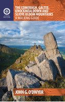
| John G. O’Dwyer’s comprehensive guide to the best walks in Tipperary and Waterford has now been updated and expanded to include Laois and Offaly. From the rugged Comeragh coums to the stately peaks of the Galtees, and from myth-laden Slievenamon to the sequestered glens of the popular Slieve Bloom Mountains, there are walks to suit all tastes in these uplands. The most captivating outings the region has to offer are shared here, along with all the necessary practical information such as maps, directions, the degree of difficulty and estimated duration. But this is more than just a walking guide. Each route gets beneath the skin of this ancient landscape littered with historic artifacts. A booley on a hillside tells how the uplands contributed to human survival; a working farmstead demonstrates the continuation of this tradition; a ruined cottage confirms a battle lost. This guidebook will appeal to committed hillwalkers and casual ramblers alike, as well as containing much of interest to anyone who wishes to better understand the age-old interaction between humans and hills.
| €15
| 978-1-84889-347-4
|
The Kerry Way (Walking Guide)
| 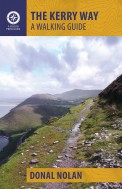
| The Kerry Way is Ireland’s longest waymarked trail and one of the most popular. Looping around the Iveragh Peninsula, it follows narrow country roads, forest paths, abandoned coach roads and mass paths, national park land and farmland. This clear and lively guide gives the prospective wayfarer enough information to plan and enjoy every step. It offers a detailed description of the trail plus lively asides on geology, history, folklore, settlement, flora and fauna. Above all, this guide will keep the reader from getting lost. The trail description is broken down into sections from the first step out of Killarney, through the high passes in the MacGillycuddy’s Reeks, into the splendour of the Ring of Kerry, and back to Killarney. This guidebook is a light, lively guide to this 200km walk, with enough guidance, cultural background and natural history to ensure the user stays on trackto arrive at their car, hostel or B&B.
| €13
| 9781848892354
|
The Mourne and Cooley Mountains (Walking Guide)
| 
| The Mourne and Cooley Mountains are quite simply a hiker’s paradise. These exhilarating walks will take you to the highest point in Northern Ireland, to scenic Slieve Foye and the ancient summit of Slieve Gullion. On routes steeped in the legend of the Táin Bó Cúailgne, trek through picturesque woodlands. Discover the highest passage tomb in Ireland, use an old smugglers’ route and walk alongside tranquil reservoirs. The more ambitious will relish the Mourne Wall and Mourne Seven Sevens challenges, and some summits include optional scrambles to the top of dramatic granite tors or rocky outcrops. Each graded route is illustrated with photographs and specially drawn maps. Snippets on the rich flora, fauna, geology, history, heritage and folklore of each area are included throughout. So, get your walking boots on and discover the impressive landscape that inspired C.S. Lewis’ magical world of Narnia and served as the backdrop for Game of Thrones
| €15
| 978-1-84889-346-7
|
Ireland's County High Points (Walking Guide)
| 
| Whether a leisurely rambler or a serious hill walker, there’s a good chance you’ve visited or plan to visit at least one of Ireland’s County High Points. While this special set of Irish hills and mountains continues to attract more visitors each year, they’ve never had a walking guidebook exclusively devoted to them. Ireland’s County High Points – A Walking Guide explains everything you need to know as a walker before setting out on your County High Point quests. Each county-focused chapter contains a brief county profile and detailed walking route descriptions accompanied by easy-to-read maps. Also featured are various challenge options based on County High Points. This definitive guide is based on detailed desk-study investigation combined with on-site research, and dispels any commonly-believed myths that may have previously lingered over certain County Top and County Peak locations.
| €18
| 9781848891401
|
Donegal Sligo Leitrim (Walking Guide)
| 
| The northwest of Ireland provides a diversity of walks, from the wild, untamed landscape of Donegal to the gentler hills and green valleys of Sligo and Leitrim. This guidebook describes 27 walks of various grades, accompanied by quality photographs and specially drawn maps. Walk descriptions also include material on the rich natural history, folklore, geology and place names of the area. Since most routes are not signposted or waymarked, an up-to-date guidebook is essential. This will inspire you to get your walking boots on and start exploring this majestic landscape.
| €15
| 9781848891395
|
The Beara and Sheepshead Peninsulas (Walking Guide)
| 
| The Beara and Sheep’s Head Peninsulas lie in the southwest of Ireland, pointed fingers of land wedged between the Kenmare River, Bantry Bay and Dunmanus Bay. They are peaceful, unspoiled peninsulas where the wild and largely untamed nature of the landscape immediately casts its magical spell. There is no better way to explore and experience this stunning landscape than on foot. This guidebook describes some of the best walking routes in the area: from Dursey Island and Bear Island to the Caha and Shehy Mountains, from the forest trails of Glengarriff to the lakes of Glaninchiquin,and from the tip of the Sheep’s Head to the ridges of Peakeen and Seefin. The routes range from short hikes to longer treks, coastal and inland, something to suit everyone’s interest. Each route is prefaced with a reference summary and illustrated with maps and photographs. Route descriptions include GPS coordinates, navigation guidance, access notes and short variations. There is also material on the fauna, flora, folklore, history, geology and place names of each area.
| €15
| 9781848892347
|
Carrauntoohil, MacGuillycuddy Reeks (Walking Guide)
| 
| The MacGillycuddy's Reeks are Ireland's highest mountains with Carrauntoohil tallest at 1039m. Occupying about 100 square km., they stretch from the picturesque Gap of Dunloe in the east to Glencar in the west. Attracting over 25,000 walkers annually, they are a wonderful playground. However, many routes are not clearly marked and mist or fog covers them for three quarters of the year. Access to a proper guide is therefore essential before venturing on to the Reeks. This guide to 20 popular walking routes on the Reeks contains full-colour maps specially commissioned from the Ordnance Survey, clear photographs and precise map references. However, this is not just a walking guide. It also encompasses the history of the area, its geology and natural history, its place names and people. Useful information on travel and accommodation is also provided. It will be the most comprehensive guide to the area to be published for some time.
|
| 9781905172337
|
Tipperary and Waterford (Walking Guide)
| 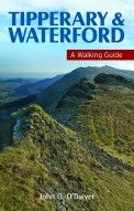
| John G. O’Dwyer has walked the mountains and moorlands of Tipperary and Waterford for many years. His comprehensive guide to the best, most captivating walks in these counties features walks to suit all tastes, from the rugged Comeragh coums to the peaks of the Galtees, from the myth laden hills of Slievenamon and the Devil’s Bit to field systems and ancient pathways in Upperchurch and Kilcommon. Each walk description has directions, the degree of difficulty, estimated time and maps. But this is more than just a walking guide. Each route is a journey with a story about a landscape littered with historic artefacts. A booley on a hillside tells how the uplands contributed to human survival, a ruined cottage confirms a battle lost. This guidebook describes walks not just for committed hillwalkers and casual ramblers: it also contains much of interest for environmentalists, historians and all who wish to understand the age-old interaction between humans and hills.
| €15
| 9781848891449
|
Kilarney to Valentia Island The Iveragh Peninsula (Walking Guide)
| 
| The Iveragh Peninsula, the largest in southwest Ireland, stretches from Killarney to Bolus Head and attracts thousands of visitors annually. The Ring of Kerry coastal road winds along its fringes and sandstone peaks soar high above. It is a landscape of raw and stunning beauty from the lakes that fill the corries to the spectacular cliff scenery along its coast. There is no better way to explore this landscape than on foot. This book helps you do just that with routes ranging from a few hours to full-day walks. Explore Valentia Island, the majestic MacGillycuddy’s Reeks and sections of The Kerry Way. Go off the beaten track and explore the coast, hills and woodlands from Killarney to Cahersiveen to Kenmare. Each route is prefaced with a reference summary and illustrated with maps and photographs. Route descriptions include GPS coordinates, navigation guidance, access notes and short variations. There is also material on the fauna, flora, folklore, history, geology and place names of each area.
| €15
| 9781848892323
|
The Dingle, Iveragh & Beara Peninsulas (Walking Guide)
| 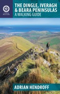
| The Dingle, Iveragh and Beara peninsulas dominate the spectacular landscape of southwest Ireland. Their rugged peaks, dramatic ridges, captivating valleys, glittering lakes and stunning Atlantic coastline form a treasure chest of walking options. This guide describes exhilarating walks in each peninsula, accompanied by the author's photographs and specially drawn maps. These walks provide a range of options, both for those familiar with the region and for first-time visitors. This region attracts thousands of walkers annually and, since most routes are not signposted or waymarked, an up-to-date guidebook is essential. The walk descriptions also include material on the fauna, flora, folklore, history, geology and place names of the area.
| €15
| 9781848891036
|
Scenic Walks in Killarney (Walking Guide)
| 
| Nowhere in Ireland has such a diversity of walks as Killarney, walks that kings and queens, writers and international celebrities have come to make in the beautiful landscape Killarney is renowned for. Heretofore there has been no guidebook for these walks and this new book rectifies this deficiency. Not only has Jim Ryan compiled eighteen of Killarney’s most interesting low-level walks, he has provided excellent photographs, precise directions and the length, time and difficulties with each. Each walk has a map indicating important features. Walks vary in duration from an hour to a day, from flat walking to more challenging rambles. Four of the walks are nature trails that follow markers, with the flora, fauna and landscape at each described. Jim takes readers through the town of Killarney, out to Muckross and Torc, down to Ross Island, and on peaceful strolls in the countryside. One of the walks includes a boat trip through Killarney’s lakes. Woven into the route descriptions are historical notes, anecdotes, folklore and natural history to add to the walker’s enjoyment. This is a book to be used and put away, then taken out again, for the visitor to Killarney, having savoured its beauty, invariably returns.
| €10
| 9781848891463
|
The Burren and the Aran Islands (Walking Guide)
| 
| The Burren and the Aran Islands, with their unique combination of flora, fauna and landscape, are explored by large numbers of walkers annually. This is a revised guide to some of the best walking routes in the region, with lucid descriptions and additional information to enhance the walkers' enjoyment and appreciation of the place. From the rugged interior to spectacular coastal scenery, from challenging upland walks to shorter road and waterside excursions, this selection has something for everyone. Every part of the region is covered. Walks vary from two-hour strolls to the longer Burren Way, a six-hour walk from Lisdoonvarna to Ballyvaughan. The author has put his considerable experience and detailed knowledge of the area to great use in putting together an easy-to-use guide that introduces the best of this region for locals and visitors alike. Each route, prefaced with a quick-reference summary, is illustrated with a clear sketch map; descriptions include detailed access information while points of interest are highlighted – geology, flora and fauna, history, archaeology and folklore.
| €10
| 9781848892002
|
Pilgram Paths in Ireland (Walking Guide)
| 
| In recent times the popularity of the Camino de Santiago has prompted renewed interest in pilgrim walks in Ireland. Increasing numbers now follow ancient Irish pilgrim paths to such holy places as Glencolumbkille, Croagh Patrick, Lough Derg and Glendalough. John G. O’Dwyer has walked – or, in the case of Clonmacnoise, cycled – the pilgrim trails of Ireland, from Slieve Mish in the northeast, where Christianity may have had its first dawning in Ireland, to Skellig Michael in the southwest, where the known world once ended. Each walk description has directions, the degree of difficulty, estimated time and a map. The paths are varied and suited to a range of abilities, from casual ramblers to committed walkers. In each route the author recounts his feelings and experiences, and describes the entertaining and insightful characters he meets along the way.
| €15
| 9781848891715
|
Dingle Peninsula (Walking Guide)
| 
| The spectacular Dingle Peninsula in southwest Ireland extends westward into the Atlantic from Tralee to Slea Head. Voted among the Top 100 destinations in the world by TripAdvisor and referred to as ‘the most beautiful place on earth’ by National Geographic, its landscape includes soaring mountaintops, gentle hillsides, secluded lakes and valleys, ancient ruins, dramatic sea cliffs and long, sandy beaches. This guide takes you off the beaten track to explore this stunning landscape in a variety of walking routes ranging from short hikes to full-day treks. From the wild extremities of the Great Blasket Island to the majestic heights of Mount Brandon and the comfort of the Dingle Way, there’s something for all tastes. Each route is prefaced with a reference summary and illustrated with maps and photographs. Route descriptions include GPS coordinates, navigation guidance, access notes and short variations. There is also material on the fauna, flora, folklore, history, geology and place names of each area.
| €15
| 9781848892330
|
Connemara and Mayo (Walking Guide)
| 
| Connemara and Mayo form an area known for stunning scenery and this guidebook describes some of the region's best and most spectacular walks. A wide variety of walks and terrains are covered: easy two-hour walks on surfaced paths; two- to three-hour ?at island and coastal walks; two- to four-hour gentle hill and mountain hikes; and four- to seven-hour strenuous hill walks. Detailed instructions are provided along with information regarding archaeology, history, landscape, ?ora and wildlife. Maps are included for each walk while photographs illustrate the routes and give a sense of the beautiful landscape. This is the most comprehensive walking guide to the area published for some time.
| | 9781848891029
|
Cycling Kerry (Walking Guide)
| .jpg)
| With some of Ireland’s most beautiful and untamed scenery, 400km of rugged coastline and enticingly peaceful roads, what better way to explore County Kerry than by bike? These scenic cycles will guide you along popular routes and bring you to hidden gems. In a county famous for its climbs, some of the country’s most spectacular ascents, summit views and descents feature, including the Conor Pass and Ballaghbeama. Each route description is illustrated with colour maps, photos, a gradient graph and key facts and statistics. Information is provided on the natural landmarks and historical sites you’ll see along the way. With over 2,500km of road covered, the graded routes suit all abilities, from casual to experienced cyclists. So take a trip through majestic mountains and along wild seashores: a cycle in Kerry will take your breath away in every sense.
| €15.00
| 9781848893078
|
Cycling South Dublin and Wicklow (Walking Guide)
| 
| From the doorstep of Dublin city, there is easy access to a cycling haven of deep glens, forested mountains and wild scenery, including the Wicklow Mountains. This guidebook journeys through some of the country’s best-known tourist attractions, such as Glendalough, and reveals lesser-known points of interest like the Shay Elliott memorial to the first Irish rider to wear the yellow jersey in the Tour de France. The graded routes suit all abilities, and are illustrated with colour maps, photos and gradient graphs, with information on the many natural landmarks and historical sites en route. The historic Military Road is central to many of the cycles. Constructed in the aftermath of the 1798 Rebellion, it runs from Rathfarnham in south Dublin to Aughavannagh in south-west Wicklow, with a side arm from Enniskerry to Glencree, and from the Sally Gap to Roundwood. Try your hand as a Tour de France competitor, revisiting the 1998 stage, which raced through the heart of the Wicklow Mountains, finishing in the Phoenix Park. Surprising insights and useful tips are shared throughout, allowing cyclists to enjoy the wonders and challenges of south Dublin and Wicklow
| €15.00
| 978-1-84889-344-3
|
Cycling North Leinster (Walking Guide)
| 
| With quiet roads, striking scenery and brimming with 5,000 years of heritage, north Leinster is a marvellous region to discover by bike. These twenty-nine routes, exploring coast, lake, river and canal routes, vary in distance and difficulty and are graded to suit all abilities. Greenways along canals and old railway lines are ideal for novices and families, while the adventurous can take a challenge through the mountains of Louth’s breathtaking Cooley Peninsula. Each cycle is prefaced with summary information and illustrated with photos, a custom-drawn map and a gradient graph. Anecdotes, history and profiles of interesting locals are included throughout, adding colour to coffee breaks in the sleepy villages and medieval towns that dot the picturesque landscape. All but one of the routes are looped back to the train stations from which they started, making for perfect days out. Visit the early Christian settlement of Monasterboice or the original home of the Book of Kells. Take in spectacular views across Dublin Bay or the legendary Hill of Tara. This practical and informative guide covers the scenic and the curious in this land of saints and scholars.
| €15.00
| 978-1-84889-345-0
|
Cycling Munster (Walking Guide)
| 
| With routes spanning the province, this guidebook is all you need to explore the highways and byways of Munster – on two wheels. Each route is prefaced with summary information and illustrated with a custom-drawn map and gradient graph. Routes are arranged by difficulty, from the gentlest, shortest circuits in Cork, through Tipperary, Limerick and Clare, to the thigh-burning Ring of Kerry, and Waterford’s Copper Coast and Grand Vee. Cycle stunning coastal roads on the Wild Atlantic Way. Challenge yourself on mountain passes. Pedal through tranquil woods and lakesides, charming towns and villages. Discover routes to suit all abilities and many hidden gems.
| €15.00
| 9781848892620
|
Wandering Ireland's Wild Atlantic Way (Walking Guide)
| 
| Following the spirit of the world’s longest coastal driving route, Paul Clements sets out to discover the real west of Ireland. Along the way he encounters memorable characters living on the Atlantic edge and presents a unique portrait of their lives. We meet the last man standing on a remote Galway island, listen to the banter at Puck Fair, and hear from a descendant of the original sixteenth-century wild Atlantic woman. Tagging along on his meandering journey is the swashbuckling presence of the Celtic sea god, Manannan Mac Lir. For his first travel book in 1991, Paul hitchhiked the same route. Now retracing his steps along the Wild Atlantic Way – this time by car and bike, on horseback and on foot – he looks at how Ireland has changed and realises everyone still has a story to tell. Laced with wry humour and endless curiosity, this is a distinctive mix of travel writing, social history and nature.
| €13.00
| 9781848892606
|
Dublin Strolls (Walking Guide)
| 
| This bestselling guide to Dublin’s architecture is filled with easy-to-follow walks through the city, with clear maps, expert architectural insights and fascinating historical detail. Dublin’s long history has had a visible impact on its architecture: waves of invaders and the attempts by Dubliners to shake them off have left their mark, with the 1916 Easter Rising, for example, having left whole parts of the city in ruins. It was not all strife, however: the Georgian era saw gracious streets and squares being laid out. This book invites you to emulate Leopold Bloom in strolling through the city. Each walk follows on from the one before and gives clear architectural descriptions, accompanied by beautiful hand-drawn illustrations. Discover: Hidden Dublin (including Isolde’s Tower, the remains of a 13th-century defence tower discovered in the 1990s along with the skulls of a number of young men whose heads had been displayed on spikes) Religious buildings (from Christ Church to the burial place of St Valentine) The buildings involved in the 1916 Rising (including the Royal College of Surgeons, City Hall, Liberty Hall, Kilmainham Gaol and, of course, the GPO).
| €13.00
| 9781848892712
|
Family Walks Around Dublin (Walking Guide
| 
| Need inspiration for a great family day out? Here are thirty imaginative and varied walks specially designed to appeal to children, all within County Dublin. Explore some of the county’s finest landscapes and historical attractions – including Ardgillan Castle, the Hell Fire Club, Bull Island and Killiney Hill – or enjoy the delights of the city and its suburbs, strolling by the Dodder, the Grand Canal or through Marlay Park. The walks are accompanied by clear directions and packed with ideas for pit stops to keep curious kids excited. Tales of folklore, historical snippets and information about the flora and fauna along the way are sure to keep them enthralled while they stay active. With detailed maps and practical information, you’ll have all you need to enjoy a fun, affordable family day out. So open the front door and discover the adventure, history and nature waiting on your doorstep.
| €14.99
| 978-1-84889-311-5
|
Cycling South Leinster (Walking Guide)
| 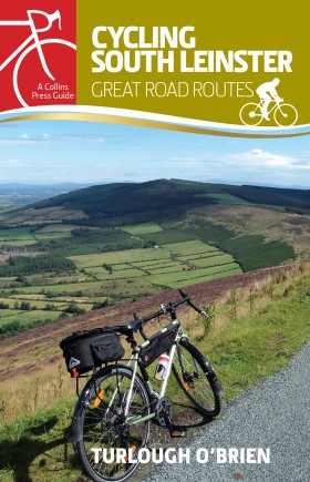
| South Leinster has a surprising variety of terrain, boasting canals, blanket bogs, rolling woodlands, golden beaches and brilliant green pastures interspersed with fields of golden barley. Quiet roads with excellent surfaces make this beautiful corner of Ireland perfect for exploring by bike, with some great climbs and descents, notably in the Slieve Bloom Mountains, adding exciting challenges. A journey through this picturesque countryside is also a trip through the ages, with many historical places of interest along the way. Break your journey with pit stops at round towers, restored mansions with attractive gardens like Emo Court, traditional lighthouses such as Hook Lighthouse, or the graves of great Irish figures like Shackleton and Wolfe Tone. The graded routes suit all abilities, and are each illustrated with a colour map, photos, a gradient graph, and key facts and statistics. Information is also provided on the many natural landmarks and historical sites en route. Each trip guarantees a terrific day out for the curious cyclist
| €14.99
| 9781848893054
|
Explore Mourne, Gullion and Cooley
| 
| Explore the landscape and rocks of this historic corner of Ireland in a series of 10 circular walks. 15 laminated sheets 95mm X 250mm in a plastic case with colour maps and illustrations. Walks: 1.Glasdrumman 2.Cranfield 3.Mourne Heartland 4.Fathom 5.Mullaghbane 6.Ravensdale 7.Slieve Foye 8.Slieve Gullion 9.Donard Loop 10.Tievedockaragh
|
A series of 10 circular walks for everyone to enjoy. Explore the beautiful countryside of Mourne, Gullion & Cooley in easy-to-follow and fully illustrated guides. Information cards on the geology, archaeology & folklore of the region are also included to help you enjoy the area to the full.
The walk series is produced under the "Landscapes From Stone" brand by the Geological Survey of Northern Ireland and the Geological Survey of Ireland with support from the E.U. Special Support Programme for Peace and Reconciliation.
|
| 1-899702-33-4
|
Explore Donegal
| 
| A 120 mile exploration suitable for cars, through the heart of the Donegal Highlands. The tour includes sites of scenic, cultural and geological interest. |
A series of tours, suitable for cars, ranging in length from 80 to 180km. The routes are designed to take you through areas of scenic interest. The Explore series is produced under the “Landscapes from Stone” brand by the Geological Survey of Ireland and the Geological Survey of Northern Ireland.
| €1.25
| 1-899702-36-9
|
Explore Oriel
| 
| A 65 mile exploration suitable for cars, through the heart of County Louth. The tour includes sites of scenic, cultural and geological interest.
| €1.25
| 1-899702-38-5
|
Explore The Bann & Roe Valleys
| 
| An exploration of the Bann and Roe valleys. The tour includes sites of scenic, cultural and geological interest. |
A series of tours, suitable for cars, ranging in length from 80 to 180km. The routes are designed to take you through areas of scenic interest. The Explore series is produced under the “Landscapes from Stone” brand by the Geological Survey of Ireland and the Geological Survey of Northern Ireland.
| €1.25
| 1-899702-26-1
|
Walk Mourne, Gullion & Cooley
| 
| Explore the landscape and rocks of this historic corner of Ireland in a series of 10 circular walks. 15 laminated sheets 95mm X 250mm in a plastic case with colour maps and illustrations. Walks: 1.Glasdrumman 2.Cranfield 3.Mourne Heartland 4.Fathom 5.Mullaghbane 6.Ravensdale 7.Slieve Foye 8.Slieve Gullion 9.Donard Loop 10.Tievedockaragh |
A series of 10 circular walks for everyone to enjoy. Explore the beautiful countryside of Mourne, Gullion & Cooley in easy-to-follow and fully illustrated guides. Information cards on the geology, archaeology & folklore of the region are also included to help you enjoy the area to the full.
The walk series is produced under the "Landscapes From Stone" brand by the Geological Survey of Northern Ireland and the Geological Survey of Ireland with support from the E.U. Special Support Programme for Peace and Reconciliation.
| €6.50
| 1-899702-33-4
|
Walk The Sperrins
| 
| Explore the landscape and rocks of the peaceful Sperrin Mountains in a series of 10 circular walks.
| €6.50
| 1-899702-27-X
|
Walk The Bann & Roe Valleys
| 
| Explore the landscape and rocks of North Derry and Antrim in a series of 10 circular walks.
| €6.50
| 1-899702-35-0
|
Walk South Ulster
| 
| Explore the landscape and rocks of South Ulster in a series of 9 circular walks.
| €6.50
| 1-89970243-1
|
Walk Cuilcagh
| 
| Explore the landscape and rocks of West Cavan and South Fermanagh in a series of 10 circular walks.
| €6.50
| 1-899702-13-X
|
Walk Donegal
| 
| Explore the landscape and rocks of majestic Donegal Highlands in a series of 10 circular walks.
| €6.50
| 1-899702-34-2 |
Landscapes from Stone
| 
| P.J. McKeever, N. Kearns-Mills, E. Gallagher (1998). Landscapes from Stone introduces the visitor to the scenic attractions of Ireland (North). Covering 14 areas the map highlights areas with well established walking trails, forest parks and blue flag beaches. The reverse of the map highlights areas where the geological heritage of particular areas can be examined.
| €1.00
| 1-899702-18-0
|
Cuilcagh Mountain Walks
| 
| Explore the landscape and rocks of the beautiful Cuilcagh Mountains in a series of 10 walks
| €6.50
| 1-899702-13-X
|
Cuilcagh Scenic Drive
| 
| The Scenic Landscapes and Rocks of Counties Cavan and Fermanagh. A 50 mile drive around the highlands of Cavan and Fermanagh
| €1.00
| 1-899702-11-3
|
Upper Erne Scenic Drive
| 
| The Scenic Landscapes and Rocks of Counties Cavan and Fermanagh. A 90 mile drive around the scenic upper Erne countryside.
| €1.00
| 1-899702-12-1
|
The Causeway Coast
| 
| The Giants Causeway is the best known geological feature of the North Antrim coast, but there are many other sites of considerable interest. This book explains the geology of the area in a global context placing them in the context of plate tectonics. It relates how the rocks which now make up Ireland moved across the surface of the world through geological time and how they came to shape the extraordinary landscape of this very special area. The well-illustrated excursions are central to the book, providing the reader with the means to explore the sites themselves. It is written to encourage visitors to delve into and understand better the area's geological history.
| €12.00
| 978-1-907053-64-1
|