The airborne low-level geophysical survey, comprises of measurements of magnetic field, radiometric and electrical conductivity of the Earth’s near surface. The geophysical data is a valuable tool for improving geological maps, assessing peat resources, understanding environmental radioactivity and promoting mineral exploration as well as other areas of research and planning.
 1. Production flying 1. Production flying
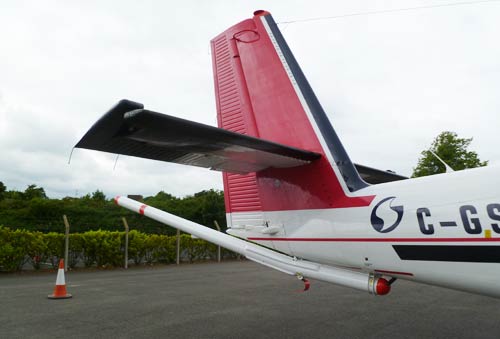
- Magnetic, electromagnetic and gamma-ray spectrometry data are collected by the aircraft as it flies 60 m above the ground
|
 2. Magnetics 2. Magnetics
|
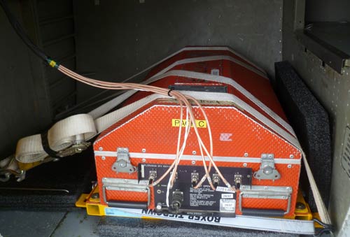 3. Gamma-ray spectrometry 3. Gamma-ray spectrometry
|

4. Electromagnetic - The electromagnetic signal is transmitted from the right hand side pod and signal received in the left
|
5. Interpretation - Following data quality checking, the data is made into maps and geological interpretation undertaken
|