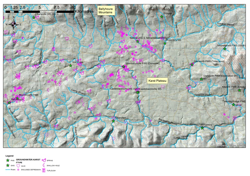
In North Cork, groundwater provides over 30,000 m3/d of drinking water via public water supplies, the majority of which are karst springs. Previous hydrogeological investigations have been conducted by Geological Survey Ireland and EPA in relation to these springs. The Groundwater 3D work represents a continuation of work in these areas.
The study area includes the fluvio-karst terrain cut by the Awbeg and Funshion river systems (Figure 1). These rivers are two of the major left bank tributaries of the Blackwater itself. The area forms part of what is referred to in geological circles as the "Munster Synclines or the "Munster Ridge and Valley Province", the characteristic form of which comprises east-west trending anticlines (sandstone ridges) and synclines (limestone valleys).
The main activities included:
- Bedrock field mapping and drilling by the Geological Survey Ireland of deep bedrock holes
- Groundwater level surveys covering an area of over 100 km2
- Flow gauging along selected sections of the Funshion river
- LiDAR data collection and processing and interpretation
- Karst feature mapping
- Hydrochemical field surveys of the Awbeg and Funshion rivers.
It is considered that the groundwater flow patterns in the area comprises diffuse and conduit flow; with the springs representative of shallow, possibly conduit driven groundwater and that there is a significant component of deep groundwater flowing south, discharging to the River Blackwater.