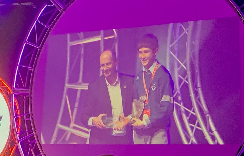
Koen Verbruggen, Geological Survey Ireland's Director, presents the Geological Survey Ireland award to Liam Cotter, from Coláiste Choilm school in Cork, for his project "Determining the Fastest Route Between Two Control Points on an Orienteering Course".
Liam, with support from his teacher Mr Paudie Scanlon, created a variant of Dijkstra's Algorithm to find the quickest route on a finite element representation of an orienteering map. Handy for geologists looking for the quickest route to an outcrop!
Geological Survey Ireland takes part in the BT Young Scientist and Technology Exhibition at the RDS every year. This year, we had another large and busy stand with students, teachers and parents coming to experience our interactive exhibits. These included gold panning with our Tellus programme, an augmented reality sandbox with INFOMAR from our Marine & Coastal Unit programme, karst and aquifer models from our Groundwater programme, a geological map and rock challenge from our Mapping programme and a 3D tectonic globe that shows how Ireland moved through geological time. This year we were joined by the Petroleum Affairs Division, the Dublin Institute of Advanced Studies (DIAS) and the National Museum of Ireland.
 Thank you to all volunteers involved, to those of you visited our stand and congratulations to our winner, Liam Cotter!